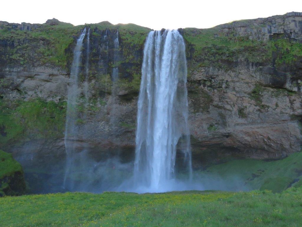
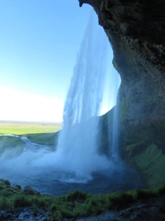
The road to Seljalandsfoss (foss means waterfall in Icelandic) goes by the huge plane that ends at the cliff wall. A powerful stream falls down from the wall – this is Seljalandsfoss. One can look at the waterfall from different sides, including from below as one can squeeze in between the wall and the falling stream.
While admiring the sights we soon get drenched so we move North by the bottom of the wall. In a half km we foind there another waterfall Gljufrabui – smaller but beautiful as the first one..
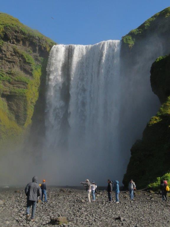
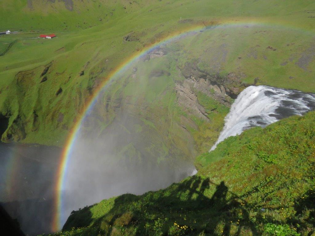
Skogafoss is the next waterfall. This as well falls from the high wall down to the plain in a wide stream. Wide staircases go to the waterfall. The route goes further transformed in a wide mountain path that follows the river uphill. Some smaller waterfalls, mountain pastures and other lovely sights.
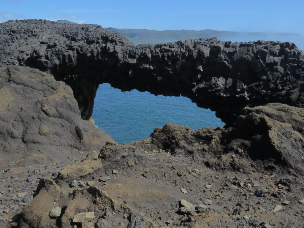
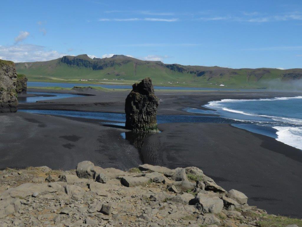
Next we proceed to Dyrholeay arch – a huge cliff at the sea shore near Vik. There are a number of cliffs scattered in a sea, the arch being the most impressive both in terms of size and form. Not easy to see it as it is partly covered by clouds. Vik is famous for its black beach. The black sand is hot and look excellent.
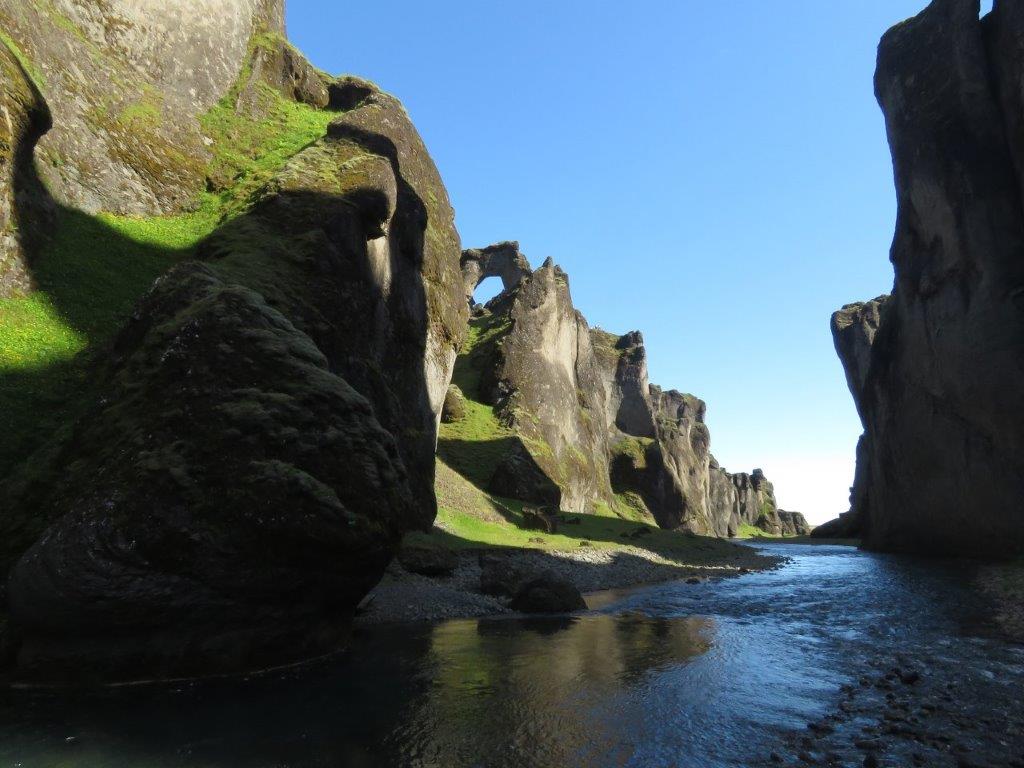
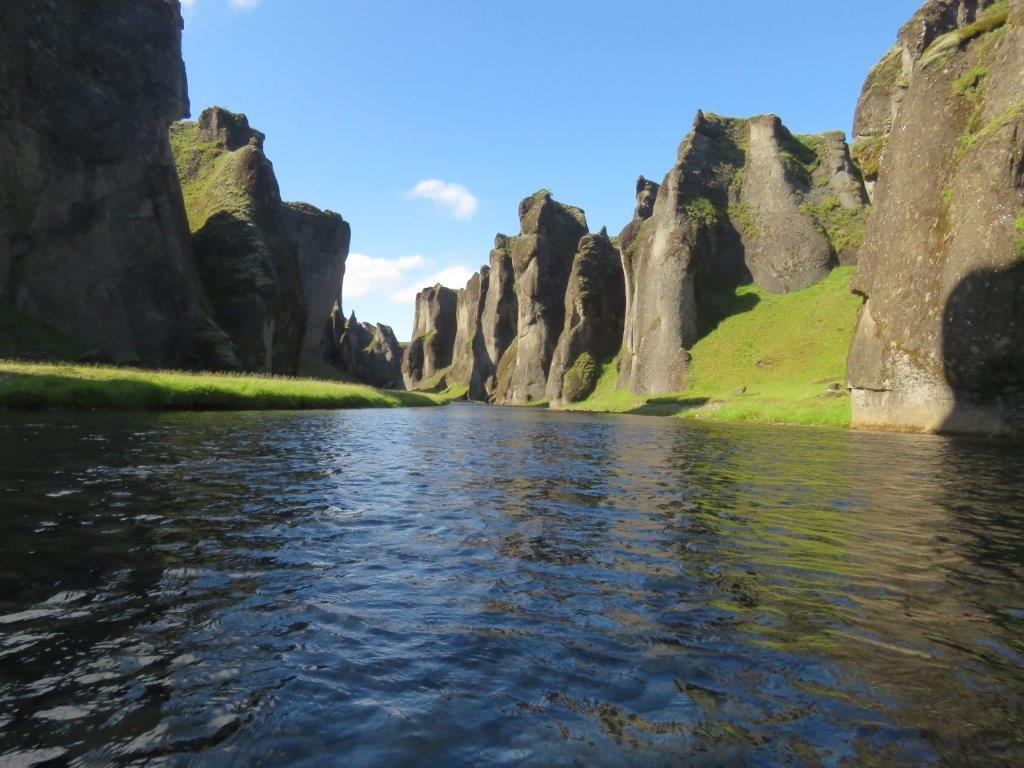
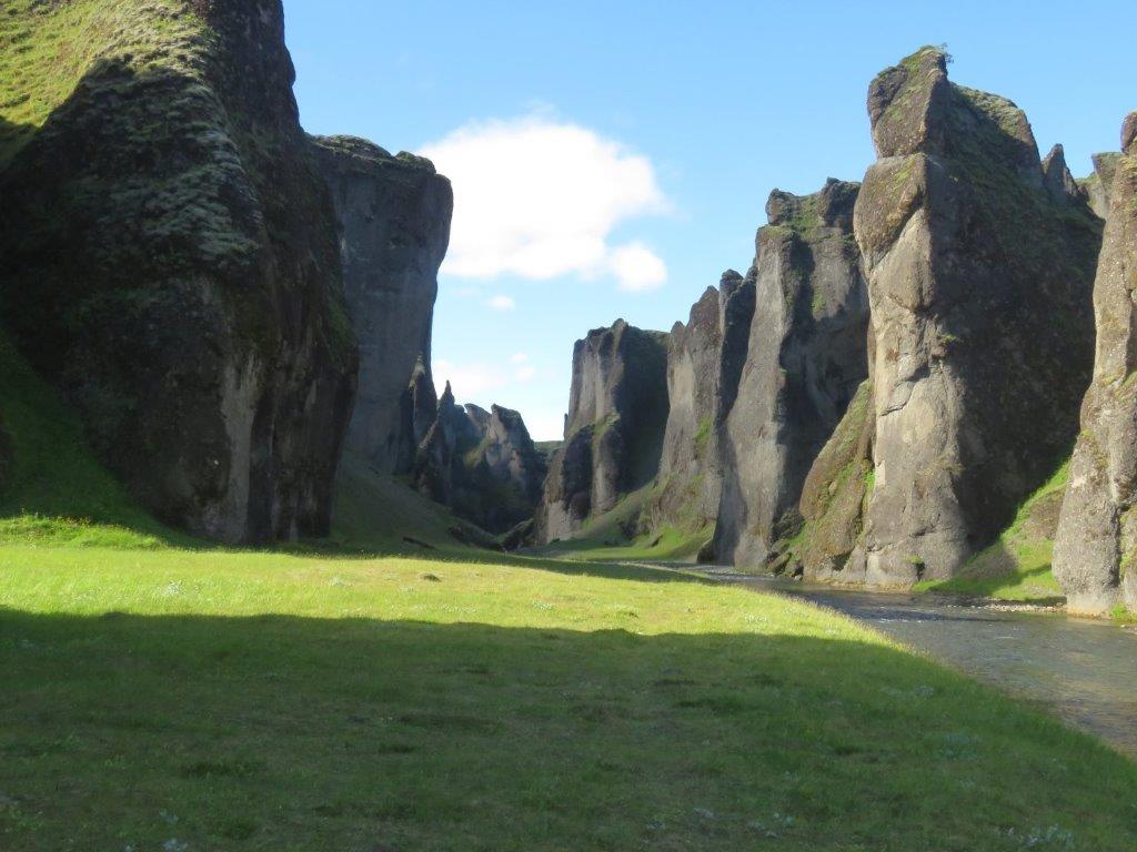
Deivid, our host in Selfoss , suggested that we should explore the canyon of Fjasrargljufura. The path goes by the top of the canyon walls, still the sights are more impressive from the bottom of the canyon. No path here and one has to cross the stream from time to time. Ilze experiences this as well.
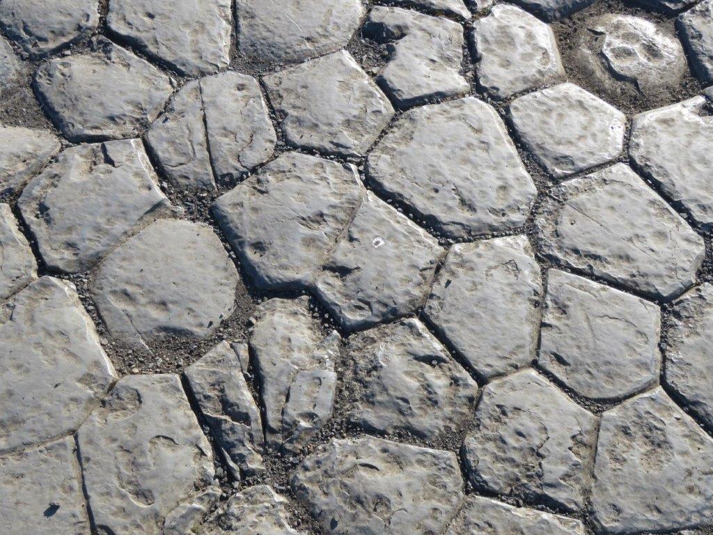
At the end of the day we walk the track near Kirkjubajarklaustur (try ro remember this 🙂 ) village. Waterfall, lake Systravatn, mountain path and a basalt formation that looks like a tile floor of the church. Still the basalt hexagons have formed naturally – when magma cools down it shrinks and breaks into this form of pieces.