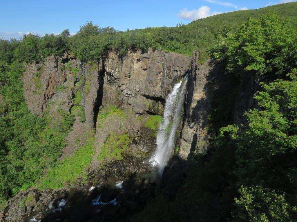
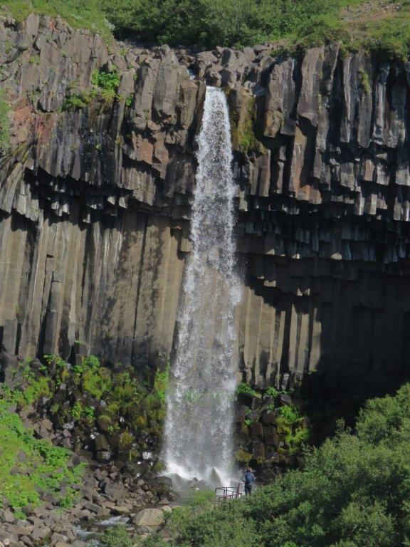
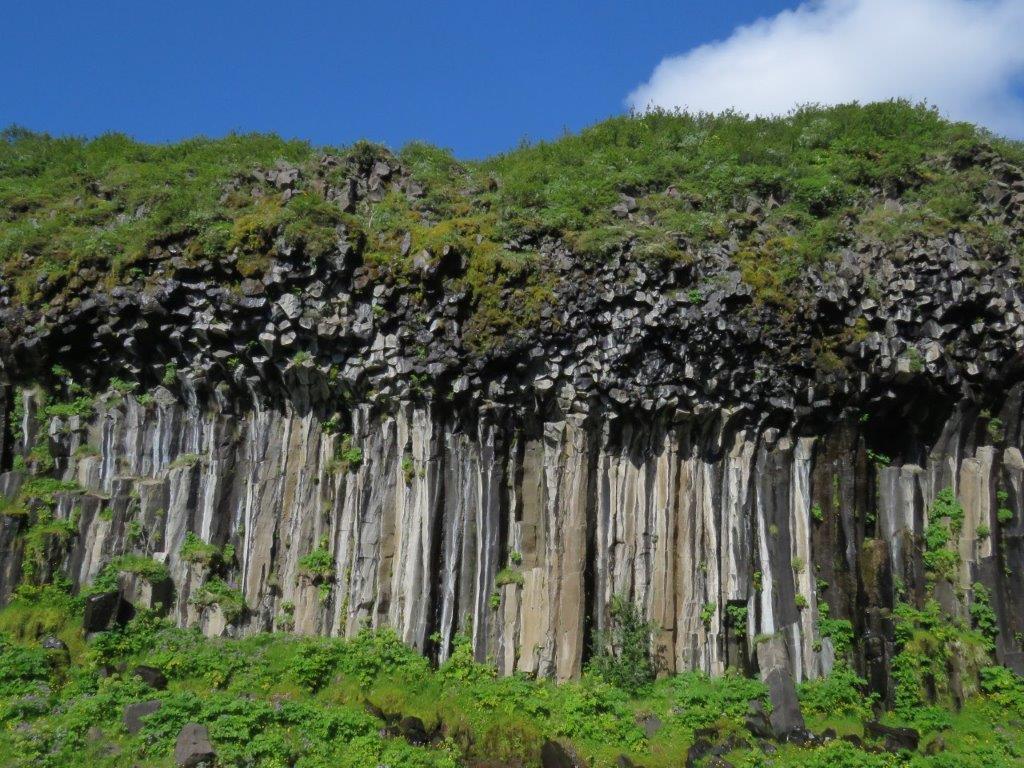
Skaftafell national park is located near the ocean at the South-East corner of Vatnajokull – the largest glacier of Europe. The glacier is nearby but we go first to explore the Svartifoss waterfall that falls down from the wall of basalt columns.
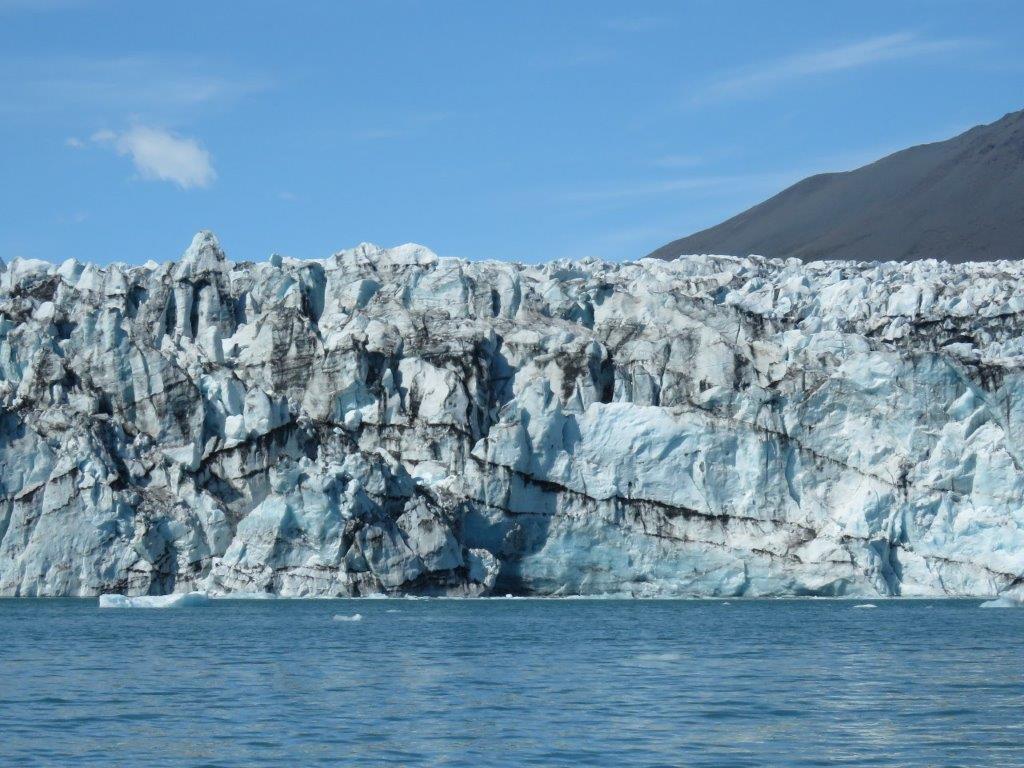
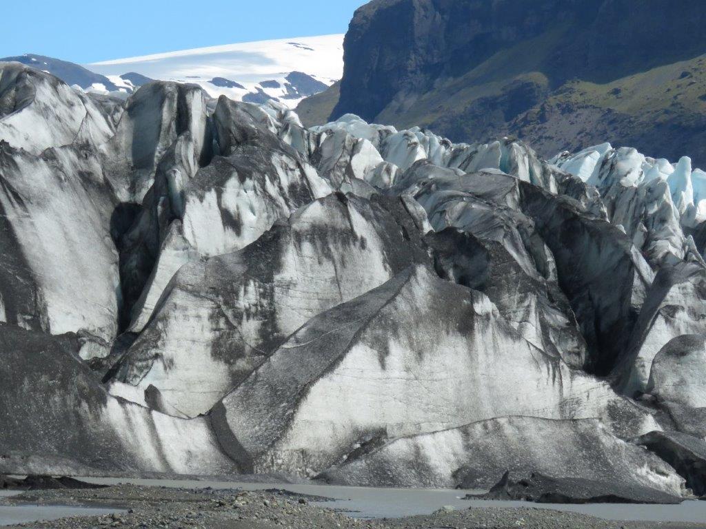
Then we return to the Svartifoss tourist information center and go in the opposite direction to one of the Vatnajokull tongs (or fingers as they are called by locals). There ar some 2km to go and as we go closer it gets colder. Not possible to approach the glacier itself as it is protected by a small lake. Still the glacier looks huge and gorgeous across the lake as well.
We drive further by the gap between the Vatnajokull and the sea (it is an ocean but is called the Norwegian sea 🙂 ). Vatnajokull melts down and because of that tow lakes have formed where icebergs fly back and forth. We stop first by the smallest one – Fjallsarlon, to look how tourists float on different kinds of vehicles in between the icebergs.
Jokulsarlon lake is larger and more impressive, the competition here is tougher as well. We attempt to apply for a guide tour on a zodiak (a form of a rubber motorboat that takes almost to the glacier). Unluckily all boats are sold out till the end of day. Other tours are available not earlier than on couple of hours.
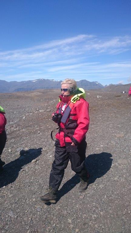
When we earlier approached the parking lot we noticed another boat office – so we drive back to look what is available there. When we get there a zodiak is ready to go and has a couple of vacant places for us. We rapidly put on red overalls and life jackets and hurry to the buss. It takes us to the lake. When out of the buss we get a safety instruction and get into the boat. Passengers sit on the sides (on a sort of rubber pipes) and secures themselves holding by the safety ropes. When the boat drives fast it is not allowed to stand up. As the guide told – the water is cold.
It is about 7km to the glacier. Each year the distance increases by another 200-300 meters – the glacier melts down. This was very alarming news to hear.
We approach the glacier as close as about 100m distance. Guide says it is dangerous to get any closer (it looks though that some boats take risk). While we watch and take shots ice goes down in a couple of places and crashes into the lake.
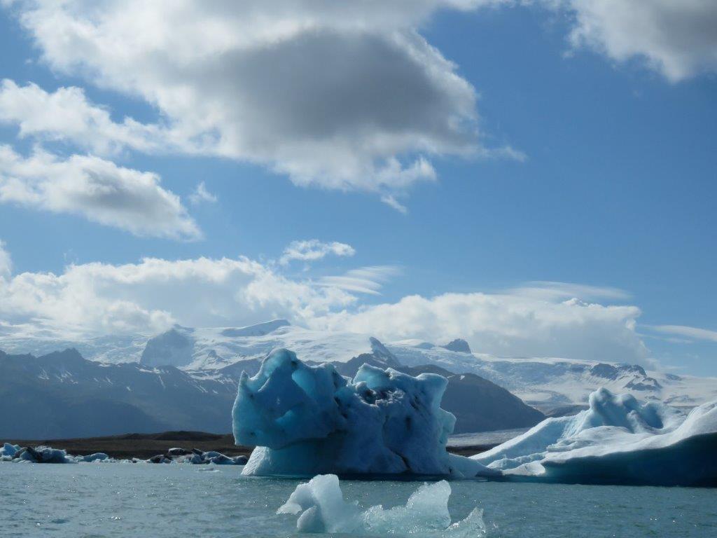

The lake has zones with a brownish water and other zones with a blue water. The first one comes from the glacier, the other is a sea water, that gets there during a high tide. Icebergs go back and forth – to the sea during the low tide and back during the high tide. So the icebergs float here until they melt down ir float to the sea and melt down there.
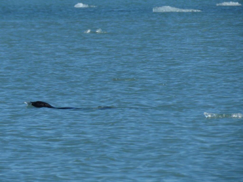
On a way back we stop next to icebergs of different colors and forms. The guide tell that they flip with the back upside from time to time – the submarine part melts faster and therefore it gets lighter and lighter until the heavy upper part takes its place. We notice several seals swimming between the icebergs.
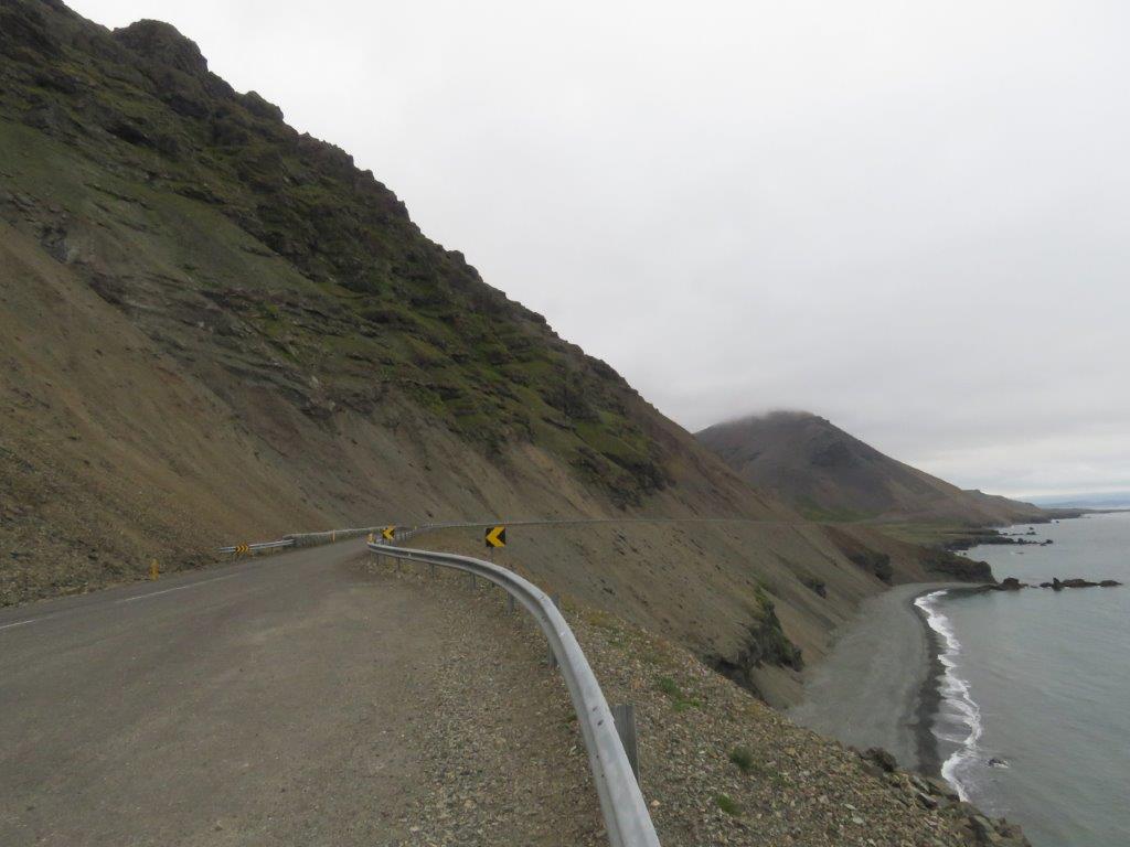
We drive next still further to the East. Some time we can still see Vatnajokull but then we get into Icelands Eastern fjords. The highway is more or less carved into the hill slopes near the sea shore. Having driven about 300km we arrive at our next accommodation in Djupivogur.
Svartifoss