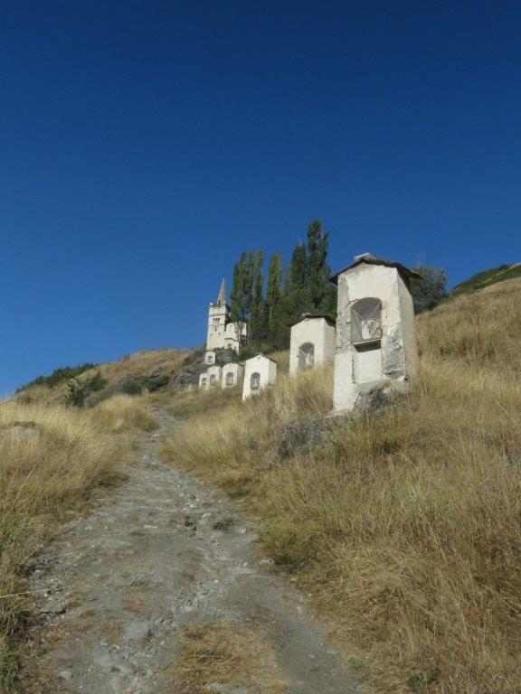
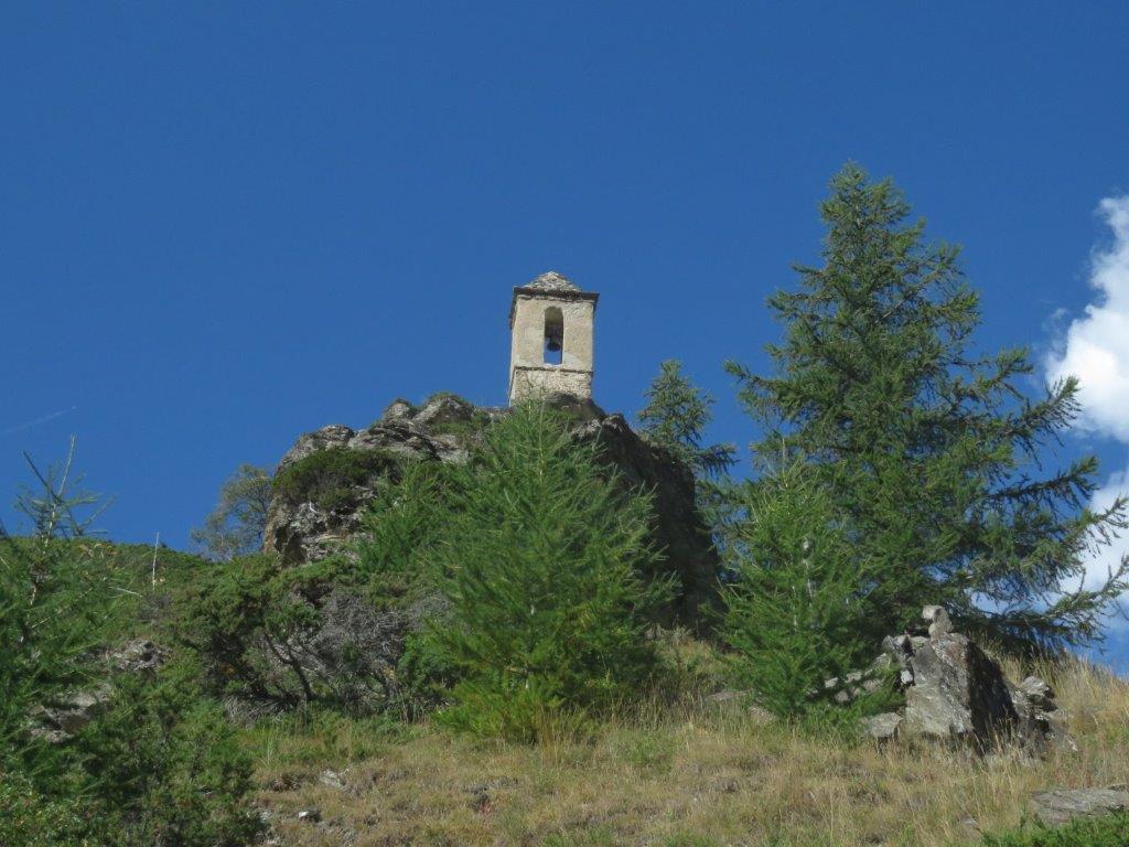
Our hotel is located next to the the stream Torrent du Bouchet. The embankment that is meant to protect the town from the flooding is right at the front of the hotel. Its top is at the same level as out balcony. The embankment is a promenade for people and dogs. The walk by so close it is easy to imagine that we could touch them from where we are. Just behind the couple of meters wide Torrent du Bouchete there is a petanque square – it is occupied every evening. There is a highway just behind the square and on the other side of the highway a slope of the opposite mountain starts – a couple of rows of houses there and the meadows behind. Right opposite to our windows the path goes uphill to the old church by 12 little chapels of cross stations. The church and the chapels are illuminated lightly at evenings. Our track to the lakes and summit of Malrif starts by this path.
It appears the path to the old church is rather steep, perhaps that’s why they built another one down in the town and the old has been abandoned? The path at the other side of the church goes by the balcony parallelly to the highway. We almost run unto a brown viper that hides instantly in the grass near the path. Further the path turns away from the highway and follows the ravine of Malrif stream.
An easy walk takes us up to the Malrif village. It has a dozen of houses, part of them looks more like ruins. Others are in process of reconstruction. One could wander how the building materials reach tjis place – there is no road.
Next on our way uphill is Les Bertins meadow. The trees gradually disappear there and a vast valley with alpine meadows and marmots come instead. Shepherds on the hill slope above us conduct sheep herd on the opposite slope. Not easy to distinguish but it looks like shepherds give instructions to dogs and they do the job.
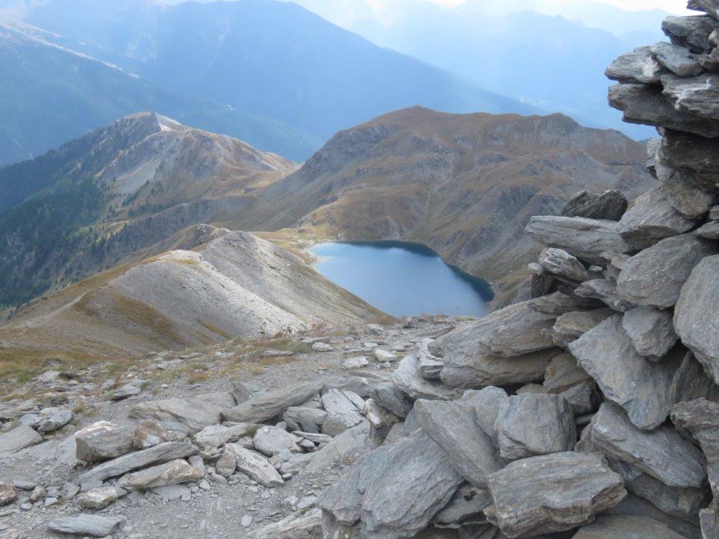
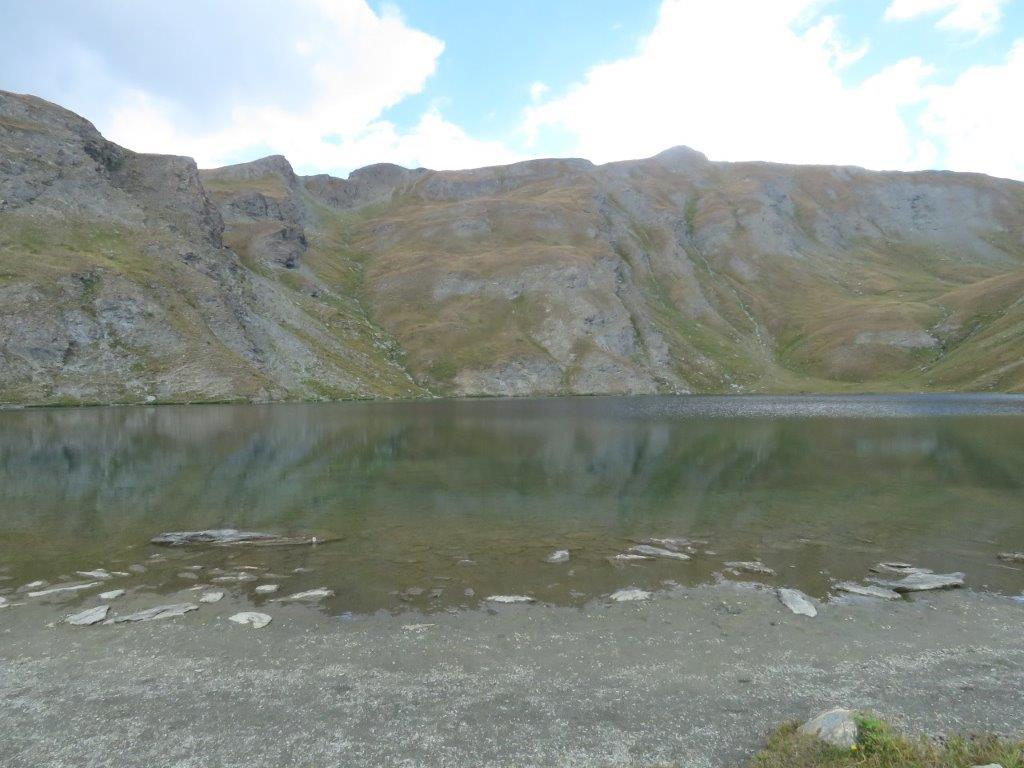
Next we proceed uphill on the slope to the left and reach a beautiful blue-green lake Lac le Grand Laus – the largest of Malrif lakes. Clouds stroll over our heads and some of them even manage to produce some rain drops. A cold wind blows from time to time. We put on all clothes we have and have a quick lunch. Then proceed to the Malrif pass.
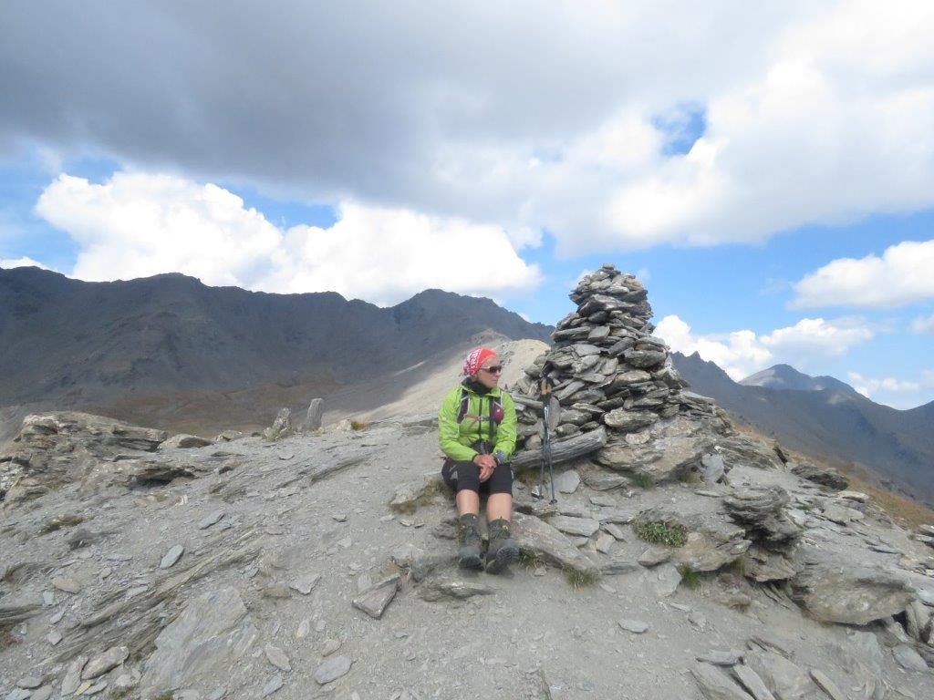
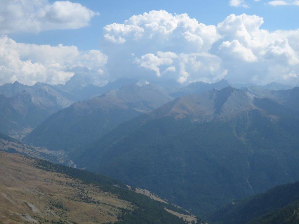
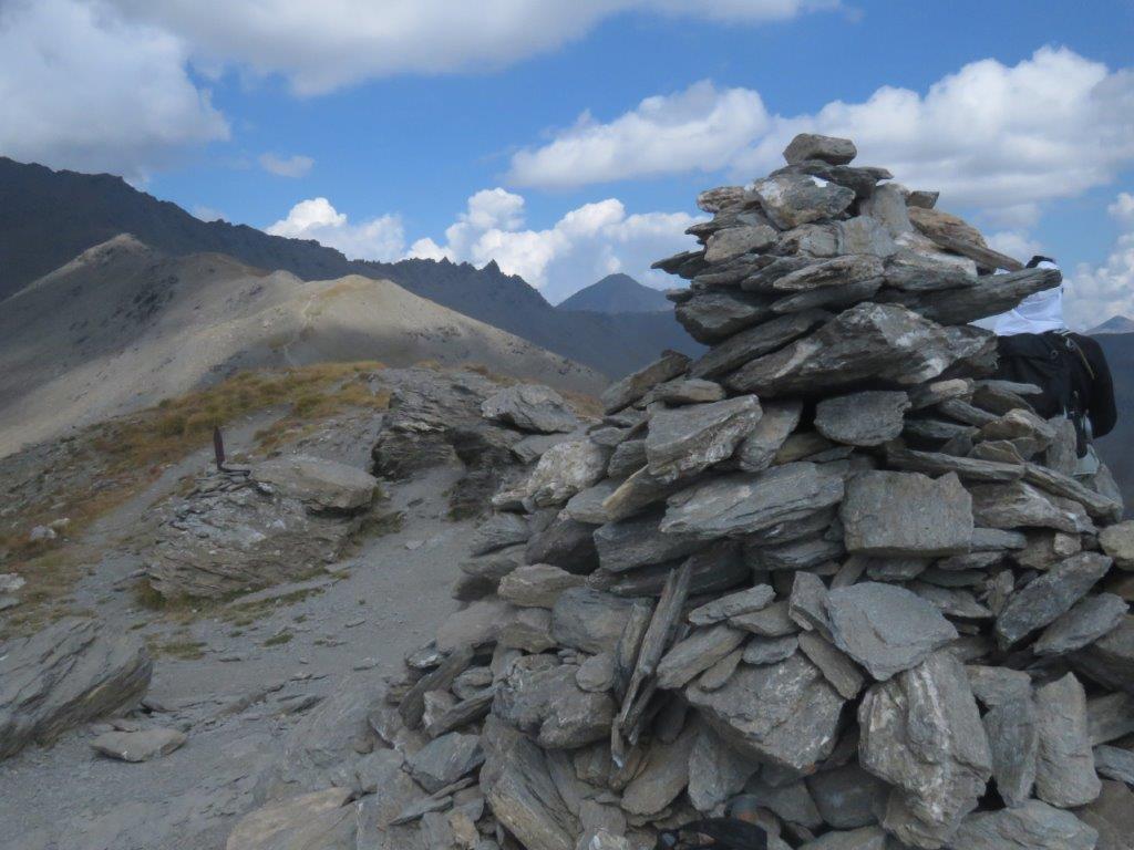
The walk to the pass is the toughest and it gets the revelation that we are at the Petit Col de Malrif (the smaller path). The Malrif summit is nearby luckily – some 120m higher (2906m above see level). In 0 minutes we are there. A lot of clouds there still mostly on top of the summits. Monviso shows up shortly but then wraps up in clouds.
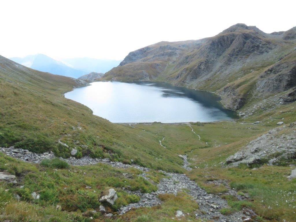
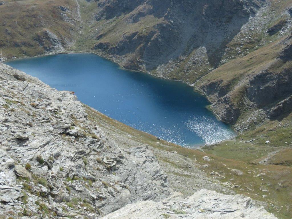
We select another path for return – by the mountain ridge. The lake shines in sun beams. We stop here for the second time to get some rest and then proceed downhill. Short rest then before the Malrif village for some spa for our foot in the Malrifa stream. The water is really cold.
The final part of the track is much longer than it should. Returning to our hotel a little after 6pm.